We’ve put together this summary of transport and location options.
By Public Transport (Strongly Recommended)
- Check Transport for NSW
or the TfNSW Opal Travel App for real-time information, timetables and route maps
or call 131 500 - Use your Opal Card or contactless payment for all public transport
By Train
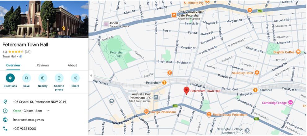
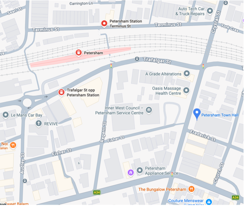
Petersham Town Hall is a 3-minute walk from Petersham Station; and the train is the most convenient way to reach the venue.
Petersham Station is on the following lines:
- T2 City/ Inner West <> Leppington / Parramatta Line
- T3 City/ Inner West <> Liverpool / Lidcombe Line
- From the City or Central Station: board the T2 or T3 line. Alight at Petersham Station.
- From Sydney Airport: board the T8 to Central Station, change trains and board the T2 or T3 to Petersham Station.
- From the Western Suburbs and other areas of the Sydney Metro region, check Transport for NSW for your best route.
Change trains at Strathfield/Burwood or Central/Redfern for connections from other lines. - On exiting Petersham Station, walk south along Crystal Street — the Town Hall is approx 250m from the station. (See maps below).
- Services run at least every 15 minutes off-peak; more frequently during peak hours.
- The station has lift access, and is wheelchair-accessible.
The route from the station along Crystal Street is relatively flat and footpath-accessible.
By Bus
Several bus routes service the Petersham area, particularly: 412 / 445
- The closest bus stops for the Town Hall are outside Petersham Station on Trafalgar Street. (see maps below)
- Other routes along New Canterbury Road and Stanmore connect to nearby stops within a short walk of the venue.
Park & Ride
The TfNSW Park&Ride system provides up to 18 hours free parking at easily accessible commuter car parks.
- Simply tap on & off for your journey with your Opal Card or credit/debit card linked to a Transport Connect account, and tap again as you exit the dedicated Park&Ride Car Park
- The dedicated car parks are found across the Sydney Metro region, including at Ashfield (just a 5-minute train ride from Petersham Station)
For more detailed information on the TfNSW Park&Ride service and locations
By Car
The main route to Petersham is via Parramatta Road, whether from the City or the Western Suburbs.
- Allow extra time for peak-hour traffic.
- Please note that parking in the area is very limited.
Nearby Parking
| Location | Details | Distance |
|---|---|---|
| Crystal Street Car Park (Inner West Council Operated) | 126 Crystal St — directly opposite the Town Hall. Enter via Regent Street Limited spaces, inc. 2x disabled | ~50 m (across the road) |
| On-street parking | Crystal St, Frederick St and surrounding streets. Check signs for time restrictions. | Immediate surrounds |
| Petersham RSL Car Park | Off Trafalgar St. More capacity & generally easier to find a spot. | ~300 m walk |
| Chester Street Car Park (Inner West Council Operated) | 5 Chester St — Audley St Precinct. Limited spaces, no disabled | ~500 m walk |
By Bicycle
Petersham is well connected via Inner West cycling paths. Bicycle parking is available in the surrounding streets.
Plan your route using the NSW Cycleway Finder
Local Area Restaurants & Cafés
The surrounding area and nearby Audley Street precinct offer a variety of cafés and other dining options.
The Bungalow @ 340 Stanmore Road
Noi @ 108 Audley Street
Perama @ 88 Audley Street
Fich @ 98-106 Audley Street
Dai Romani @ Petersham RSL, 301 Trafalgar Street
Local Area Maps
The maps below show the key landmarks, transport stops, and amenities within easy walking distance of Petersham Town Hall.
We’re looking forward to meeting you at the show!